| From This |
 Crown copyright material reproduced with the permission of the Controller HMSO |
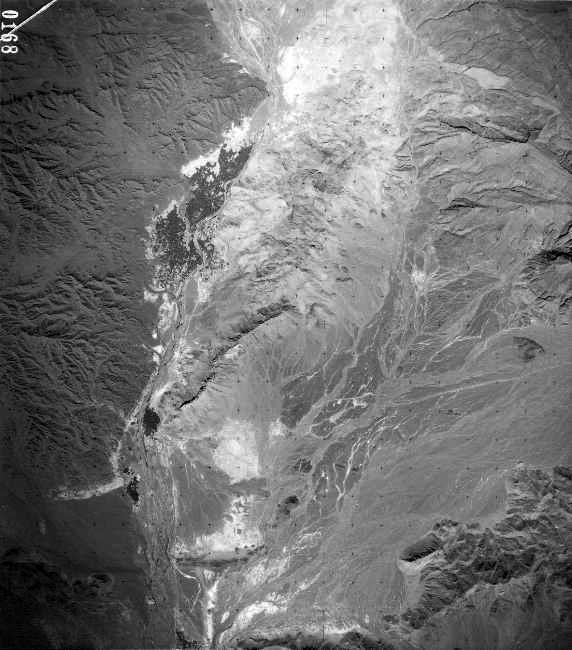
| The RAF
flew the aerial photography in
liaison with a RASLS unit
which was also responsible for
the ground control (astro
fixes & triangulation). Photos
measured 279 x 279mm and were
flown at a height which,
taking into account the
elevation of the terrain above
sea level, would give a scale
of about 1:80,000. Thus each
photo covered about 500 sq.km. Adjacent photos gave stereo cover (3-D effect) when viewed through a stereoscope. This aided enormously photo interpretation in the field |
 Crown copyright material reproduced with the permission of the Controller HMSO |
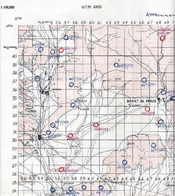
| 42 Survey Engineer Regt. in Cyprus carried out the plotting and printing at 1:100,000 of the Preliminary Unchecked Compilation (PUC) sheets which were then sent with the photos to 19 Topographic Sqn. to do the field work |
| The air
photos and PUC sheets were
field annotated to show towns
and villages, tracks and wadis,
altimeter height-point and
names-sheet reference numbers.
This PUC sheet was used for referencing height points whose elevations were determined by theodolite observations (in blue) and altimeter (in red). The precise position of each point was identified on the relative air photo and pin-pricked, with its reference number written on the back. Annotation (description of features) was usually done on the relative PUC rather than on the back of the air photo for obvious practical reasons |
| To This |
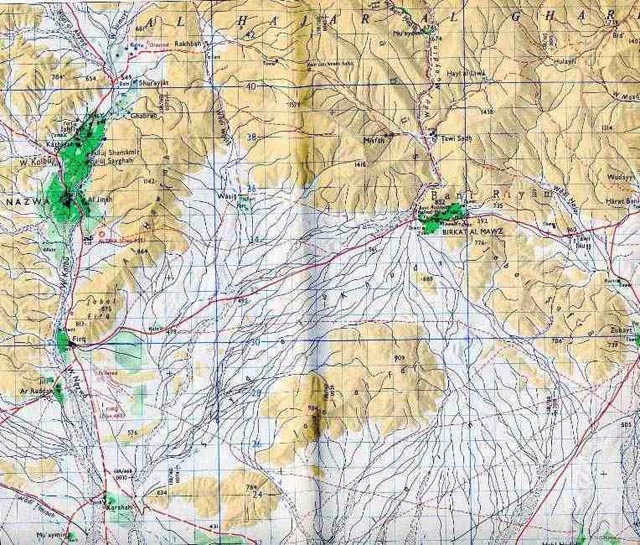 Crown copyright material reproduced with the permission of the Controller HMSO |
| The
finished product, produced by
42 Survey Engineer Regiment. This example was, I believe, printed in 1963 |
| Some
(perhaps) interesting
information:
The detail area of each Preliminary Unchecked Compilation 1:100,000 sheet was about 510 x 370 mm, which means that it covered an area of about 51 x 37 km or 1,887 sq.km. Given that the area of the Oman is about 309,500 sq.km., there would have been about 164 sheets for total coverage, although I dont know if there was in fact total coverage. The number of photos covering each PUC sheet, allowing for a 60% longitudinal overlap and a 25% lateral overlap, was about 24. Of these, some covered two or more adjacent sheets and so the average number of photos per sheet would work out at perhaps 18. The total number of photos to cover the Oman would therefore be about 164 x 18 = 2952. This seems quite a reasonable estimate.
|


